Back in 2016, we wrote that the question was not “will a bridge be built?” but “when?”. In July 2024 we reported that the project had gained serious momentum with multiple route options under study. In our 2025 long-form update, we shared how Route 3 had emerged as the leading option after technical evaluation and public input.
Now, new reporting from Daily News (เดลินิวส์) gives the clearest planning-stage picture yet. The route has been selected as the preferred alignment in the current study, the budget figure is reported at 15 billion baht, design details are released, and the timeline has been adjusted by one year.
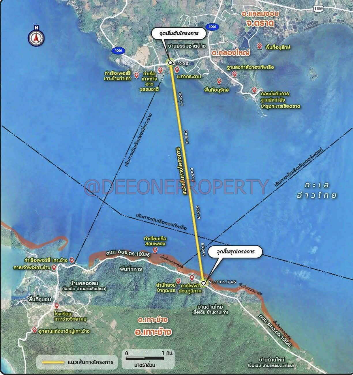
📍 Route Selected: Ban Thammachat Lang to Ban Dan Mai (5.90 km)
The chosen alignment is a 5.90-kilometre link from the mainland near Ban Thammachat Lang to Koh Chang at Ban Dan Mai. According to the report, it runs south through agricultural land, enters the sea west of the local fishing pier, crosses navigation routes, and connects to the road on the Koh Chang side.
The mainland section crosses only a small number of residential properties. Over the sea, the bridge is elevated so boats and ferries can pass underneath. On the Koh Chang shoreline, the route crosses above a coral area for roughly 100 to 150 metres, and the endpoint crosses an open-use area with only low-density housing nearby.
🔧 Design Overview
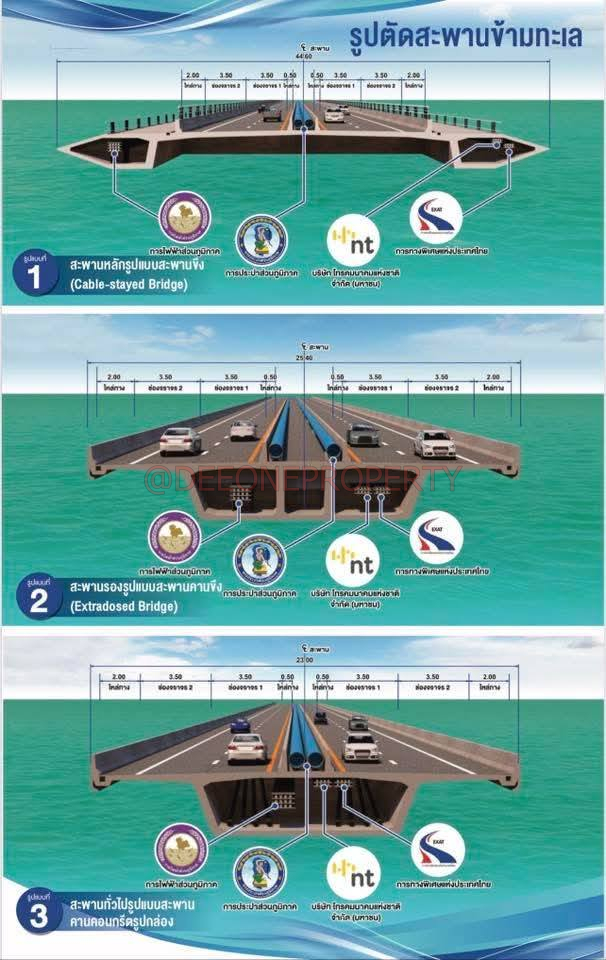
The project includes two main components.
Land-level road section
A 4-lane expressway (2 lanes each direction) separated by concrete barriers, plus a parallel service road.
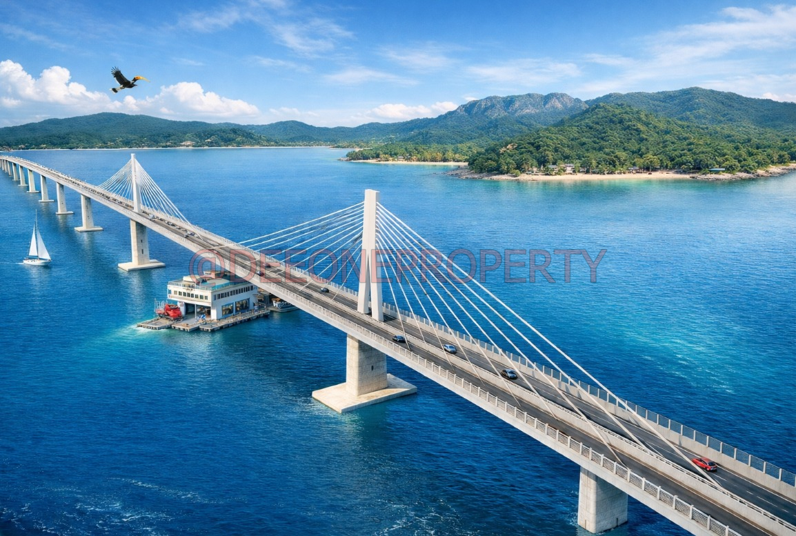
Sea-crossing bridge section
The sea bridge would not use the same structure all the way across. In the main navigation area, the bridge needs longer distances between pillars, around 200 metres, so larger vessels can pass underneath. Other sections can use more standard spacing, around 50 to 60 metres between pillars, using a box-girder style bridge deck.
🗓️ Timeline & Budget Updated
Daily News reports the budget at 15 billion baht for the 5.90 kilometre link. That is a notable increase compared with the 10 billion baht figure mentioned in earlier feasibility study coverage, which may reflect updated cost estimates as the design and technical work become more detailed.
The schedule has moved back one year because technical surveys (geology, oceanography and environmental work) took longer due to monsoon conditions.
Key dates from the report
- Late April to early May 2026: Second small-group consultation and third public hearing to summarise engineering, economic, financial and environmental study results.
- Late 2026 or early 2027: Coordination with utility agencies.
- 2028: Submission to Cabinet for approval.
- 2029: Land acquisition begins.
- 2030: Construction starts.
- 2034: Opening for service.
Once open, the bridge is expected to offer a faster, safer alternative to the ferry and reduce waiting times, especially the 3 to 4 hour queues during peak festivals.
🌿 Environmental Notes
The route crosses a section of coral reef on the Koh Chang side. Environmental impacts remain part of the ongoing review process.
🏡 Real Estate Implications for Koh Chang
With the route and timeline now clearer, the project provides more certainty for long-term planning. Areas near the endpoints may see increased interest over time:
- Mainland side: Ban Thammachat Lang and the Ao Thammachat area
- Koh Chang side: Ban Dan Mai and nearby zones
Improved access could affect tourism patterns, rental demand and surrounding infrastructure, depending on final approvals and environmental requirements.
🧭 Looking Ahead
We will continue to follow the project through the upcoming public consultations in late April to early May 2026 and beyond.
If you own land, are considering a purchase, or want local guidance near the corridor, feel free to contact Dee One Property. We’re happy to share current listings and answer any questions based on the latest information.